1.1.1. Map Size
Suppose you want to create a map of Switzerland and you want to show the whole country on the screen.
If you do not know Switzerland have a look at the popup window which contains some facts about the country: (Click here for more information)
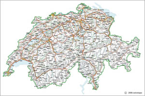
Here is an example that shows a screen map of Switzerland:
 Topographic screen map with too many elements (© 2006 swisstopo)
It is obvious that there are too many elements in the map. Even if you would look at this map on a huge screen, you would not be able to read the text elements that are contained by the map. (Be aware that for a printed map the elements may not be too many or too small, because you can print the map in an arbitrary size.)
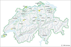
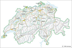
For a screen map you have to adapt the map's elements to the size of the output medium. Possible solutions for acceptable screen maps are:
 Optimized topographic screen map 1 (© 2006 swisstopo) Optimized topographic screen map 1 (© 2006 swisstopo) |
 Optimized topographic screen map 2 (© 2006 swisstopo) Optimized topographic screen map 2 (© 2006 swisstopo) |
As you can see, the two optimized maps contain less information than the original map. But since the output medium (screen) is a multiple smaller than the one of a printed map (paper), some adaptations have to be made to the original map. Otherwise the map's content is illegible. And take into account that our target is only to present the country Switzerland. For someone who does not know Switzerland, it is sufficient to show only the canton borders and the capitals of the content as an overview.
The next chapters will introduce the adaptions that lead to a quality screen map.

