1.4.4. GUI Examples
We here present you a few GUI examples for interactive screen maps. We explain shortly the possibilities of the applications and highlight the segmentation of the GUIs. You will see that there are several possibilities to arrange the GUI elements of an interactive map. We here want to show you that there is no one and only solution for the arrangement of a GUI of an interactive map. Depending on the content and the functionalities of a map, the arrangement varies significantely.
Georeferenced Photos of Switzerland
This is an application that visualises photos with a spatial reference. The location where the photos are taken is shown in the map as well as the orientation of the camera. You can look at the photos by clicking on the red points in the map. You are even able to search geographically or thematically for photos: You can select one or more thematic keywords to start the thematic search or you can select one or more administrative units to start the geographic search. The resulting photos are shown in a "Photo Selection Window". When selecting a photo in this window you can zoom directly to this photo or see the photo in higher resolution.
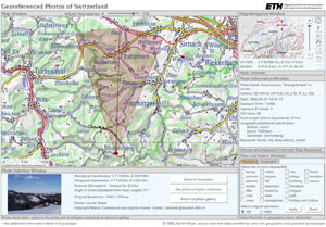 Application Georeferenced Photos of Switzerland (MEYER 2006) Application Georeferenced Photos of Switzerland (MEYER 2006) |
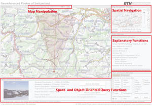 Functional Groups in the application Functional Groups in the application |
Link to the application: Georeferenced Photos
Modeling the Dynamics of Migration in Urban Areas
This
application visualises the residential segregation in urban regions (here in
Zurich). Not only geographical but also social distances are of great
importance. To calculate the social distance of a relocation movement a
"social-geographical space" is used. Appropriate this
social-geographical space has two dimensions of differentiation: status and
lifestyle. This social landscape serves to analyze social changes like the
individualisation of lifestyles and changes in segregation patterns like
gentrification or downgrading neighbourhoods. (Sotomo)
Within this application, you can select various themes, change the
classification of the data, change the colour of the choropleths, etc.
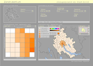 Application Dynamics of Migration (Isakowski 2003) Application Dynamics of Migration (Isakowski 2003) |
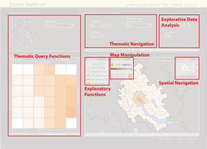 Functional Groups in the application Functional Groups in the application |
Link to the application: Dynamics of Migration
Google Maps
Google Maps is a map search engine. You can search for an arbitrary location or route. The address(es) of the location or route must be typed in an input bar. The map then directly zoomes to this location. You can zoom and pan in the map and adjust the map's appearing by toggling three map layers.
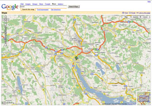 Application Google Maps (Google Maps) Application Google Maps (Google Maps) |
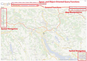 Functional Groups in the application Functional Groups in the application |
Link to the application: Google Maps
Map24
Map24 as well as Google maps is a map search engine. But Map24 features more tools than Google Maps. Besides navigating in the map, you have the possibility to measure distances, to highlight map features, to zoom out for quick orientation, etc. You even have the possibility to get a 3D-view of the map extent.
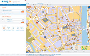 Application Map24 (Map24) Application Map24 (Map24) |
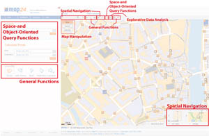 Functional Groups in the application Functional Groups in the application |
Link to the application: Map24
Atlas of Switzerland 2.0
The Atlas of Switzerland is not a web application. It is a commercial product that runs from DVD. This application is the most complex one of the ones we presented you in this lesson. It features a huge amount of tools. We only can mention the most important ones here: theme selection, navigation functions, analysis functions, possibility to compare values of the map, setting pins, loading maps, saving maps, map history, etc.
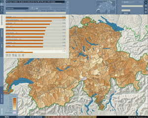 Application Atlas of Switzerland 2.0 (Atlas of Switzerland 2004) Application Atlas of Switzerland 2.0 (Atlas of Switzerland 2004) |
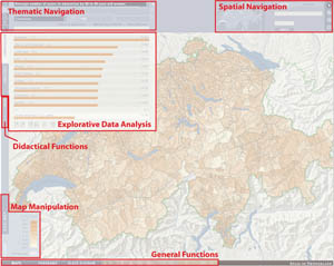 Functional Groups in the application Functional Groups in the application |
