1.4.2. Functional Group Examples
General Functions
General functions are found not only in interactive maps, but also in other media. Language selection, importing, exporting and printing files as well as help and exit functions are the most common ones.
 General Functions in Atlas of Switzerland 2 (Atlas of Switzerland 2004)
Navigational Functions
There are three types of navigational functions: spatial, thematic, and temporal navigation.
|
Spatial Navigation |
The functions for spatial navigation allow to define the position in the map via zoom, pan or by means of a reference map / globus. |
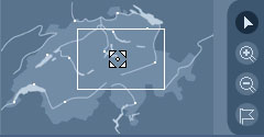 Spatial Navigation in Atlas of Switzerland 2 (Atlas of Switzerland 2004) Spatial Navigation in Atlas of Switzerland 2 (Atlas of Switzerland 2004) |
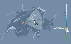 Panorama Lift and Determination Angle (Atlas of Switzerland 2004) Panorama Lift and Determination Angle (Atlas of Switzerland 2004) |
|
Thematic Navigation |
Thematic navigation functions define the orientation in the thematical structure of an interactive map. They allow the selection of a theme and the changeover to another theme.  Part of the thematic navigation in Atlas of Switzerland 2 (Atlas of Switzerland 2004) Part of the thematic navigation in Atlas of Switzerland 2 (Atlas of Switzerland 2004) |
|
Temporal Navigation |
Temporal navigation functions facilitate the temporal positioning by means of a time line or other time control elements.  Temporal Navigation (Isakowski 2003) Temporal Navigation (Isakowski 2003) |
Didactical Functions
The integration of didactical elements in interactive maps expand the information content of a map. Such elements clarify and structure the information of an interactive map. Didactical functions consist of the two sub-groups explanatory functions and self-control functions.
|
Explanatory Functions |
These functions provide explanatory texts, images, sound, films, pre-defined thematic routes (guided tours), simple models, and animations. 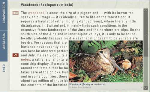 Explanatory Functions in Atlas of Switzerland 2 (Atlas of Switzerland 2004) Explanatory Functions in Atlas of Switzerland 2 (Atlas of Switzerland 2004) |
|
Self-Control Functions |
A user is able to control his/her acquired knowledge with these functions. Self-Assessements in form of games or quizzes deal with the presented subject and provide food for thoughts. Automatic feedback informs the user about the correctness of his/her answers. 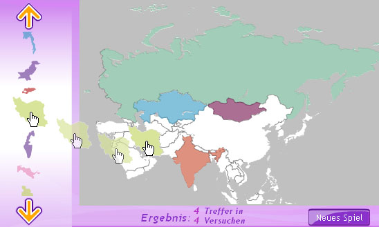 Game of the Encarta Atlas (Microsoft Encarta 2006) Game of the Encarta Atlas (Microsoft Encarta 2006) |
Cartographic and Visualisation Functions
Cartographic functions allow the graphical modification of the map on the screen. Each user can modify the visualisation of the map to his taste. Besides map manipulation, redlining and explorative data analysis are part of this functional group.
|
Map Manipulation |
The user is able to change the presentation of the screen map to his taste. For interactive maps, the most important function of this sub-group is switching on and off layers or changing of the symbolisation (e.g. colour). 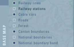 Switch on and off Layers in Atlas of Switzerland 2 (Atlas of Switzerland 2004) Switch on and off Layers in Atlas of Switzerland 2 (Atlas of Switzerland 2004) |
|
Redlining |
Redlining allows to add map elements such as labels, comments/notes, marks, or geometric elements to the existing screen maps. In doing so, the original map is not modified. 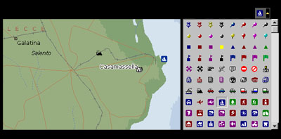 Adding Map Elements in Encarta Atlas (Microsoft Encarta 2006) Adding Map Elements in Encarta Atlas (Microsoft Encarta 2006) |
|
Explorative Data Analysis |
These functions allow to detect spatial correlations by means of data visualisation in maps, diagrams or graphics. An example is the classification modification of statistical data. |
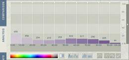 Original Data Classification in Atlas of Switzerland 2 (Atlas of Switzerland 2004) Original Data Classification in Atlas of Switzerland 2 (Atlas of Switzerland 2004) |
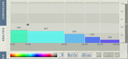 Modified Data Classification in Atlas of Switzerland 2 (Atlas of Switzerland 2004) Modified Data Classification in Atlas of Switzerland 2 (Atlas of Switzerland 2004) |
GIS Functions
GIS functions handle both graphical data and data that is stored in a database. Often, the query you send is handled in the database and the result is graphically visualised in the map. You are able as well to make only queries that are handled on the graphical side of the system. Therefore, this functional group consists of spatial and thematic query functions and of general analysis functions.
|
Space- and Object-Oriented Query Functions |
Spatial-Oriented queries provide the position (in coordinates and altitude) of the cursor. Therefore, they can be seen as a part of the spatial orientation. The measuring of distances and areas can be processed by means of the map's geocoding. 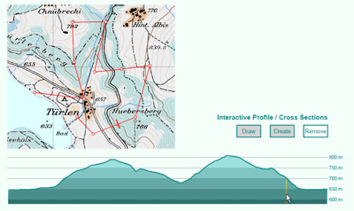 Creating Profile (Neumann 2002) Creating Profile (Neumann 2002) |
|
Thematic Query Functions |
With thematic queries, attributes (thematic data) of an identified object can be enquired.  Access to Statistical Table Data (Neumann 2002) Access to Statistical Table Data (Neumann 2002) |
|
Analysis Functions |
GIS analysis functions visualise the correlations between spatial phenomenons. They combine relational database data with spatial interpretation and output the result (often) in form of maps. The resulting map visualises the data relationships. The main functions are overlapping, creation of zones, and aggregation. The terrain is often analysed for example the exposition, slope, etc. 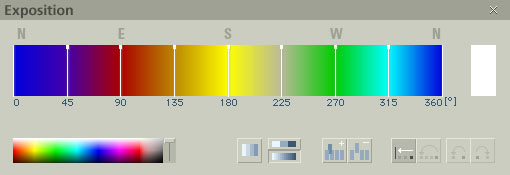 Setting Exposition options in Atlas of Switzerland 2 (Atlas of Switzerland 2004) Setting Exposition options in Atlas of Switzerland 2 (Atlas of Switzerland 2004) |
