1.5.5. Spatial Reference Options
- Coordinates on Mouse-Move
The coordinates of the mouse cursor are shown when moving the mouse over the map. Try it out in the next example. - Linked Reference Map to Provide
Overview
The reference map employs a global thumbnail of the entire document space and a box to indicate the portion of the image displayed in the main window. - Map-Extent Lines / Arrows Indicating Map Width and
Height
Map-Extent lines or arrows indicate the actual map width and height. - Scale-Bar
An interactive scale bar shows the dimensions of the actual extent. - Grid Lines
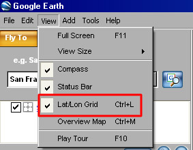
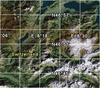
Google Earth is an application that has implemented grid lines. Since the application has to be downloaded and installed on the computer, we only show you two screenshots. If you have the rights to install applications on your computer, visit the Google Earth Website, download and install the application and explore the grid lines by yourself. You have to activate the grid lines under "View -> Lat/Lon Grid". Activating Grid Lines in Google Earth (Google Earth)
 Grid Lines in Google Earth (Google Earth)
 - "Rocket Functionality" - quick
zoom out and back to original extent
If you are zoomed in very close in a map, you easily lose your orientation because you cannot see the surroundings anymore. This method allows to get a quick overview of the question "Where am I?". Try it out on the Map24 Website. Type in your address and use the "Rocket Functionality". Rocket Functionality in Map24 (Map24)
