1.6. Self Assessment
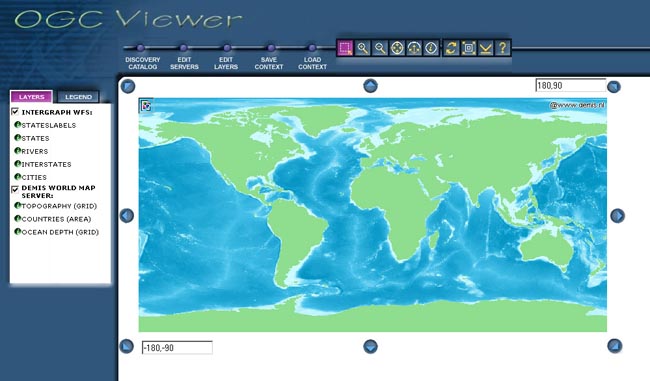
The software company Intergraph created an interactive OGC Viewer that is available on the Internet. Intergraph describes it's viewer as follows:
"Intergraph’s OGC (Open GIS Consortium) Viewer is a thin client that enables the user to view one or more OGC WMS (Web Map Service) sites as well as feature data portrayed from one or more OGC WFS (Web Feature Service) sites. The OGC Viewer sends requests, formatted according to OGC specifications, to selected WMS/WFS sites. Data from various sources and formats can be combined and overlaid in one map view. Data from a WMS can be saved as a context document and used again by its creator or another user." (Intergraph)As the description says, you are able to add a new OGC WMS or WFS server to the viewer. The button "Edit Servers" allows you to append new web servers of your choice.
We now want you to add the UMN Mapserver that we introduced you in this lesson. Try it out and explore the application.
You may first read the help instructions of the OGC Viewer (to find behind the question mark icon) and read the section "Example Workflow".
You find the OGC Viewer under www.wmsviewer.com
 Intergraph's OGC Viewer (Intergraph)