1.2.3. OGC Process
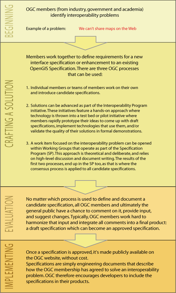
OGC has a member approved process that encourages collaboration among and between OGC members to define, document, and implement open specifications that solve geospatial interoperability problems. The OGC exists to enable a fast, effective, inclusive, user-driven process to develop, test, demonstrate, and promote the use of geospatial information and services by using OpenGIS® Specifications (OGC). The following figure shows the different steps of such a process.
 Process of the development of an OGC specification
For further information about the OGC process and the OGC Programs see
OGC and ISO
The OGC has a close relationship with ![]() ISO/TC 211. The OGC abstract specification is
being progressively replaced by volumes from the ISO 19100 series under
development by this committee. The OGC Standards Web Map Service, Simple
Features and GML (are explained later on in this lesson) for example are already
ISO standards. (Wikipedia)
ISO/TC 211. The OGC abstract specification is
being progressively replaced by volumes from the ISO 19100 series under
development by this committee. The OGC Standards Web Map Service, Simple
Features and GML (are explained later on in this lesson) for example are already
ISO standards. (Wikipedia)
