1.2. Animation and Cartography
Learning Objectives
You will be able...
- ...to explain why animation is useful for multimedia maps.
- ...to list the main developments of animated maps from 1960 until now.
- ...to list three animated map types.
- ...to propose solutions for the challenges that exist in the creation of animations.
Introduction
In former times, when the computer was only used by scientists and not by a "normal" human being, maps were always static, because they were only available in the form of paper. Since it is hardly possible to realise animated maps with static maps, the first animated maps were not breathtaking at all. The imagination of the map viewers was needed to see the map as an animated map.
|
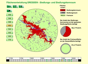
Now, in the computer era, it is much easier and also quite common to generate animated maps, even though the creation of animated maps is very time consuming. With animated maps, it is possible to visualise continuous change of attributes or entities. This chapter will give you a short summary of the history of animated maps and then show you a few animated map types. Click on the thumbnail on the right to access an example of an animated map. |
 Animation implemented in cartographic application (Institut für ökologische Raumentwicklung TU Dresden) Animation implemented in cartographic application (Institut für ökologische Raumentwicklung TU Dresden) |
