1.3.5. Interactivity
We now present you some functions that may be implemented into an interactive topographic map. The tools do not necessarily have to be implemented in a topographic map, but they are nice to have.
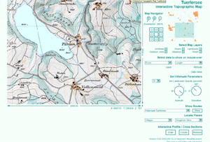
Have a look at the following example which contains a lot of possible interactive functions that can be implemented in an interactive map. Check out all the functions.
 Interactive Topographic Map of Tuerlersee (Neumann 2002)
Did you really check all the functions? The following tools you should have been checked (Click here for more information)
Since we already discussed the navigation and the map layer control tools in previous chapters, we will say no more about these points. But we want to say a few words about some of the other functions.
In general, the following functions extract only the information that the user is already able to see in the topographic map. But the information is visualised in a more pleasing way.
Profile
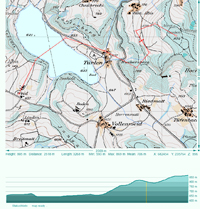
With this tool you are able to draw the profile of an arbitrary polyline.
|
It is nice to have this function for interactive topographic maps
since the topic of a topographic map is the topography. Of course the
contour lines contain already all the information but it is nevertheless
comfortable to get the difference in elevation at a glance. Especially
for bikers or hikers this information can be of particular
importance. |
 Profile (Neumann 2002) Profile (Neumann 2002) |
Read out information and display it
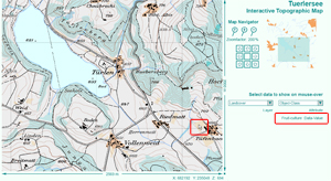
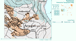
The functions "select data to show on mouse-over" and "locate places" read information out of the map and displays it in two different ways:
- The attribute data (e.g. length of rivers, object-class of landcover, etc.) is displayed as text when moving the mouse over the corresponding objects.
- The places (villages and mountains) first have to be selected in a selection list and then the map is directly zoomed to the right position.
 Displaying attribute values (Neumann 2002) Displaying attribute values (Neumann 2002) |
 Locate places (Neumann 2002) Locate places (Neumann 2002) |
The function that gives information with on mouse-over effects are
limited for topographic maps. You can only extract the information that is
already visualised in the map (e.g. landcover types are distinguished with
different colours, etc.). Of course it is not comfortable to extract the length
of a river out of a screen map, but it is possible if you would have to do
it.
You will see that in the subject of interactive thematic maps it
is also possible to visualise attribute values that are not and never will be
visualised directly in the map.
