1.2.2. Navigation
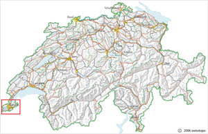
Even if we implement map layer control tools in an interactive topographic map, the map's details are still not visible. The entire map with all its detailed information is visualised on the screen. Considering the map example that we presented in the last chapter: when switching on the layers "roads" and "railroads", areas such as the surroundings of Geneva or Zurich contain too many details. These details cannot be distinguished anymore.
 Details of the marked region cannot be distinguished anymore (© 2006 swisstopo)
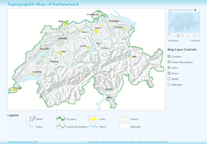
We therefore have to implement navigation tools such as zoom in/out, etc. Have a look at the following example which contains a few navigation tools. Try them out by clicking on the buttons (F stands for "Full View"; the hand stands for panning) or moving the slider bar.
 Map with implemented navigation tools
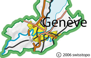
With the implemented navigation tools we are able to enlarge the region we want to:
 Zooming to a region (© 2006 swisstopo) Zooming to a region (© 2006 swisstopo) |
 Enlarged region (© 2006 swisstopo) Enlarged region (© 2006 swisstopo) |
Take into account that zooming in very close in a raster image does not make sense because the closer you are, the bigger the pixels become and you cannot see any details anymore.
